
The BIG Canyon!
The BIG Canyon
After what can only be described as a poor nights sleep, with heavy lorries moving around outside, car doors banging and general noise out the front and the back we were up early with full anticipation for A Grand Day Out. We had breakfast with us and, it was at this point, we found the fridge made a great slow-oven as we consumed the food that was likely to spoil first.
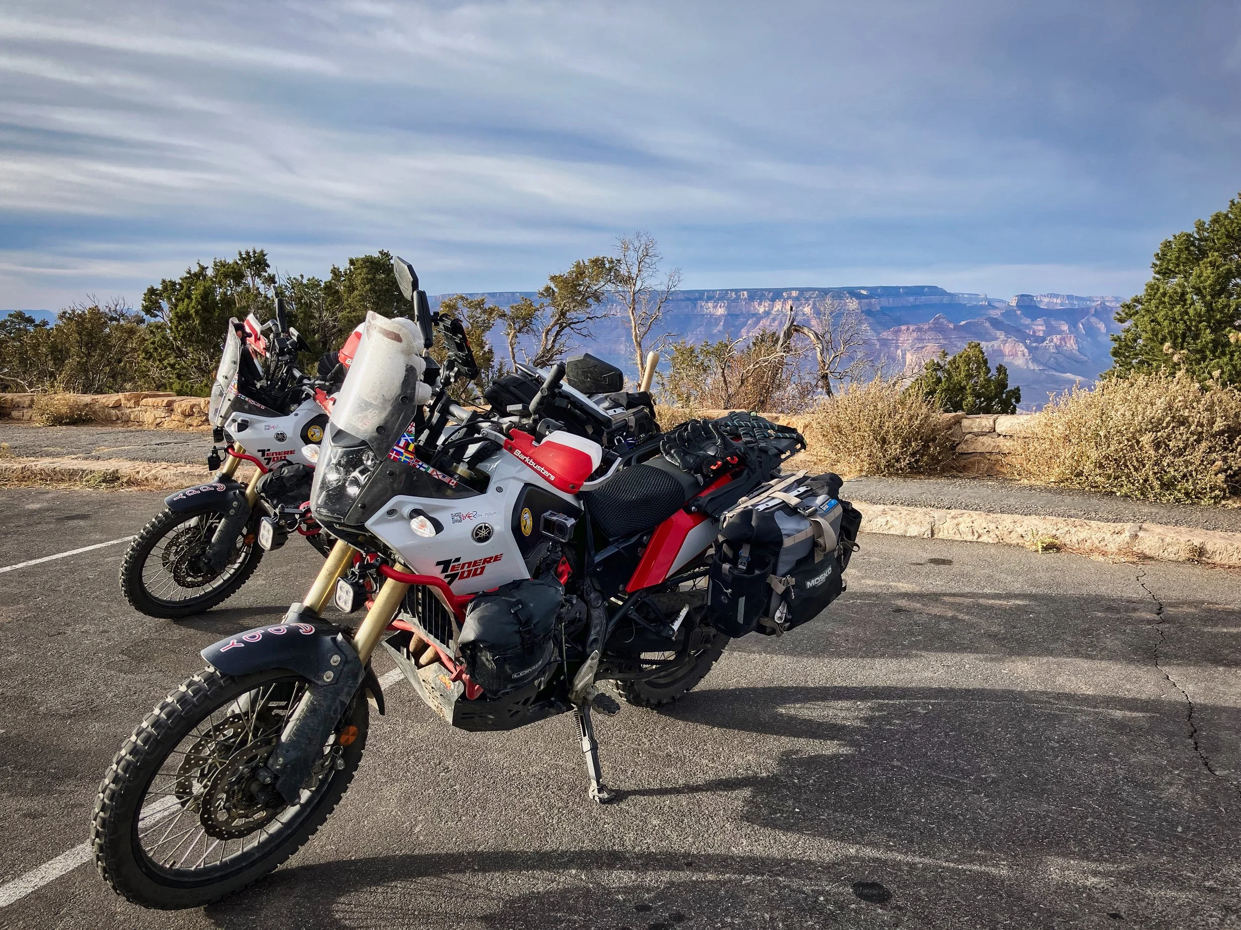
As I readied the bikes in “light load mode” and waited for Isi’s final nose powder, I watched the young cleaners moving around the rooms that had been recently vacated. There was more chatting and giggling over the latest TikTok videos than there was actual cleaning, until a car pulled up tooted its horn and the girls dropped tools, giggled more, jumped in the car and were off - seemed a treat for them but probably not for the next guests who would have to make do with barely cleaned rooms. Such a shame really, as the location was the obvious and perfect choice to make the Big Canyon, as it was formerly known, a days visit.
We left and joined the straight road heading north, the landscape was flat except for a slight and gradual rise in the direction we were travelling. Occasional buildings in various states of degradation would dot the side of the road but not much more would be seen except for low growing plants you would expect to see on any desert. Whilst generally uninspiring, our anticipation of riding off the horizon kept us in a joyful mood. We knew the landscape would change and soon.
The scenery changed as the trees reduced our sight-lines to the edges of the national park and quickly enveloped us as we reached the immaculately dressed park rangers in their gate-houses, inspecting park passes and accepting monies for those that could not produce. Not only did I need to show the pass with the signatures on the reverse, but I also had to show my driving licence to show the signature and my name matched. The ranger was about to ask Isi to do the same but, given the queue building up behind, quickly changed tack and asked me if the other signature was, in fact, Isi’s. With a prompt affirmative, we were finally allowed in the park.
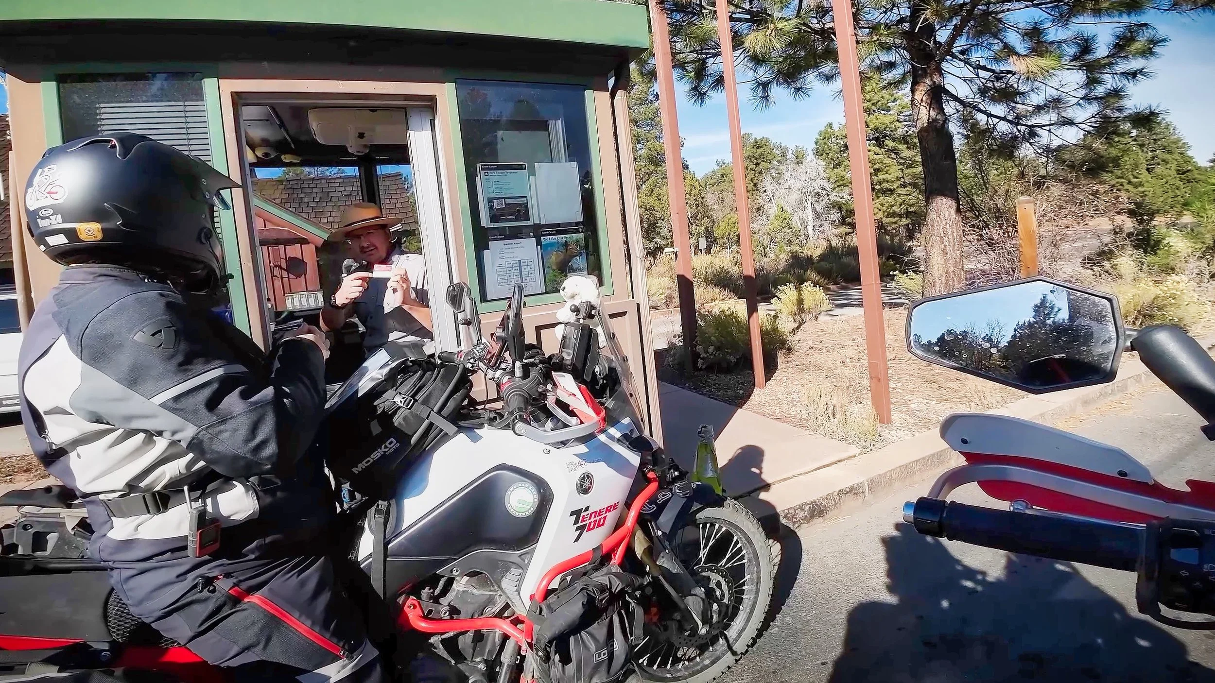
Is this your signature?
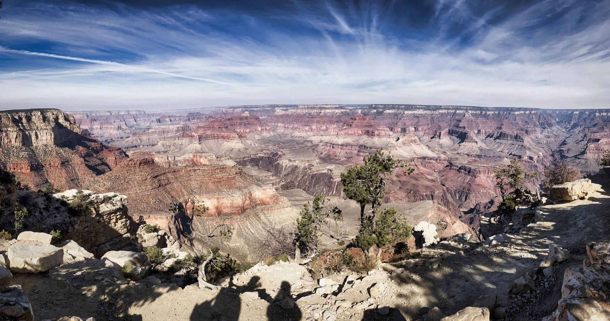
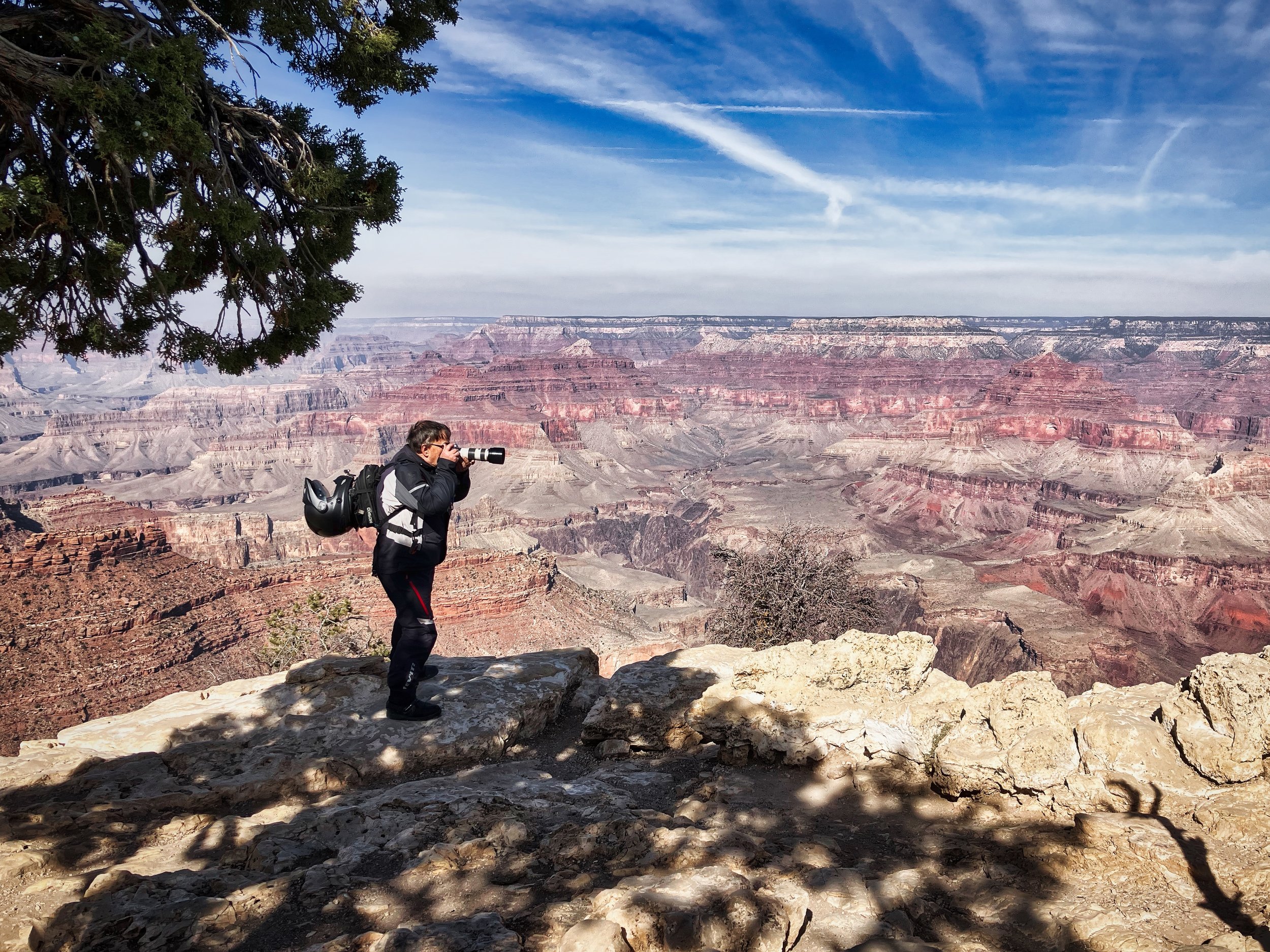
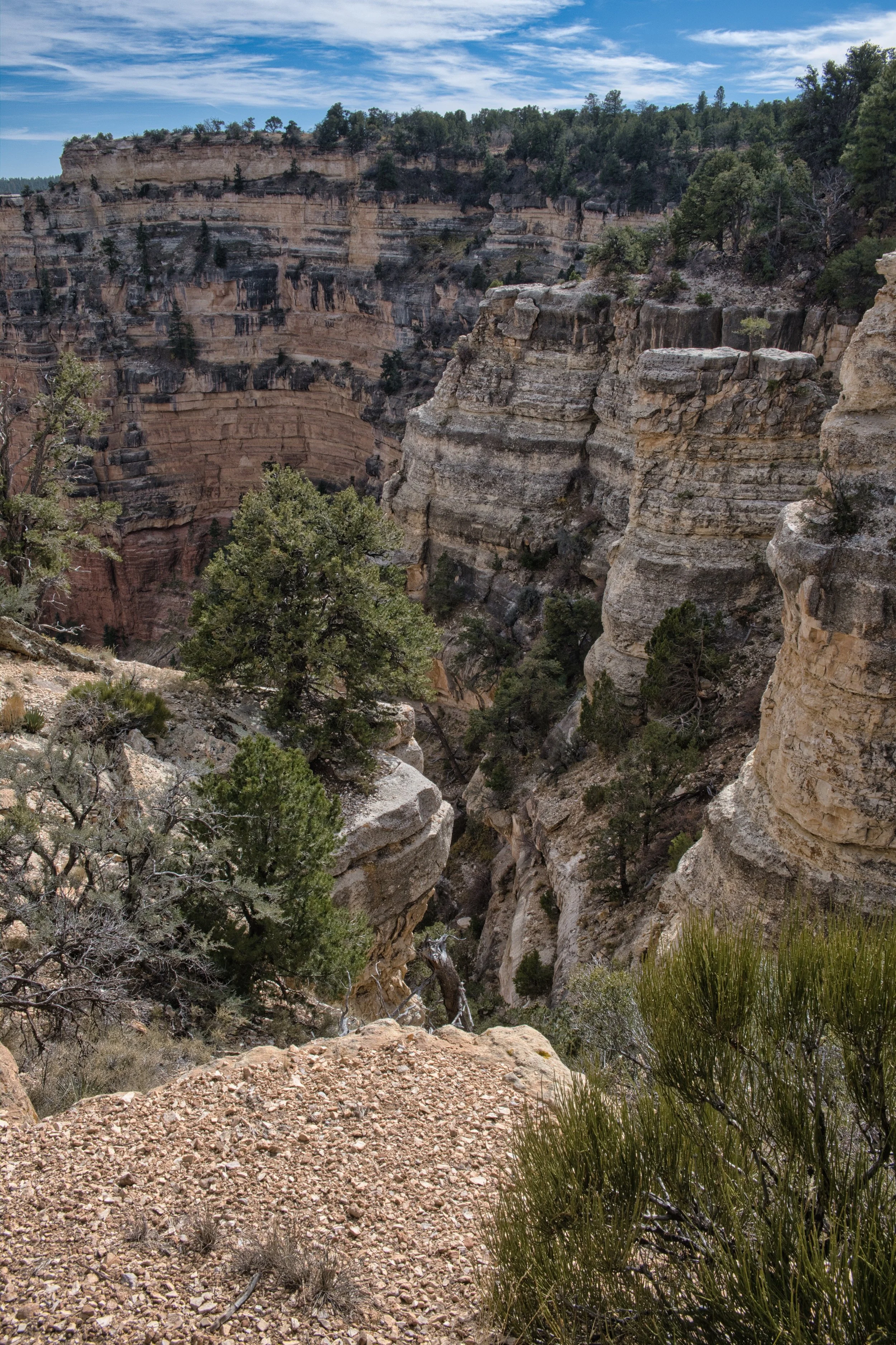
The road carried straight north, surrounded by sparse pine forest, allowing a lot of light to enter and other trees and shrubs to thrive. Signs would appear indicating a campsite (closed) or a training centre or admin buildings etc., As the road took a sharp turn right, we carried on toward the visitor centre and found a place to park just beyond. Even though we were in “light load mode”, we still had tank bags, helmets and other paraphernalia to carry whilst keeping hands free for cameras etc.,
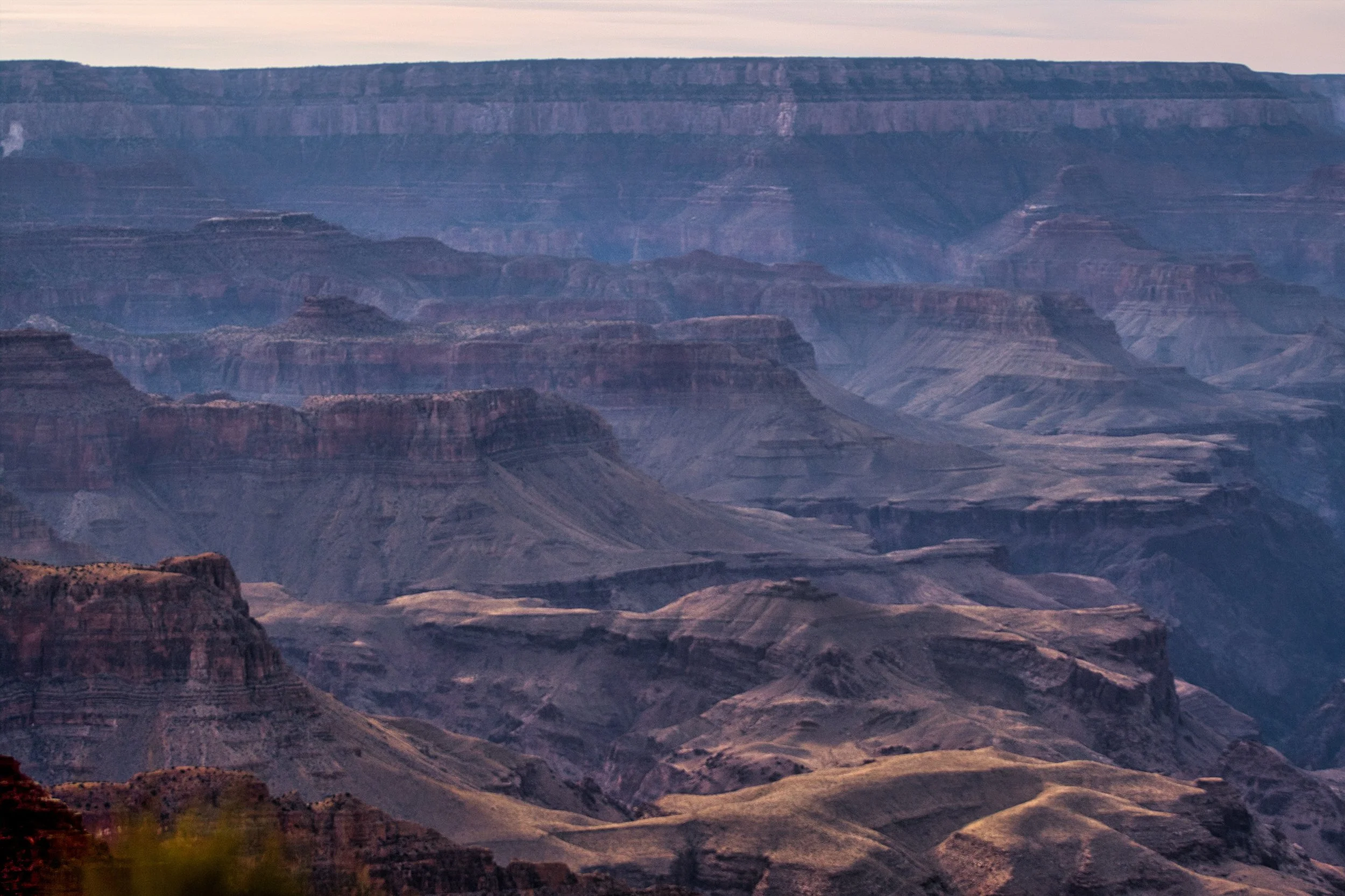
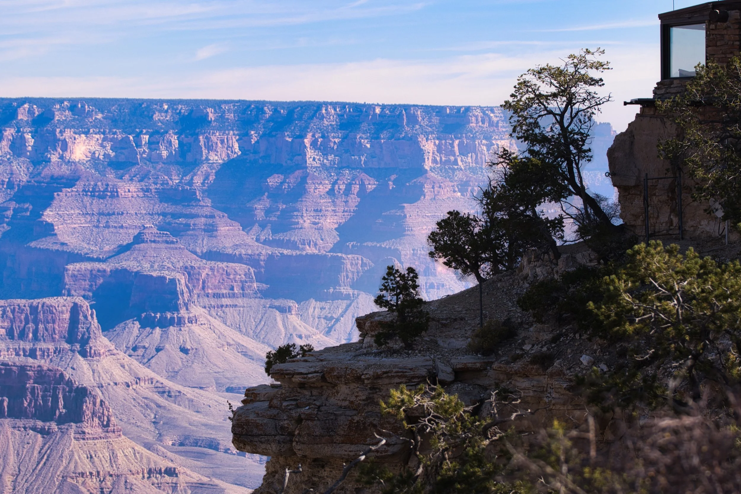
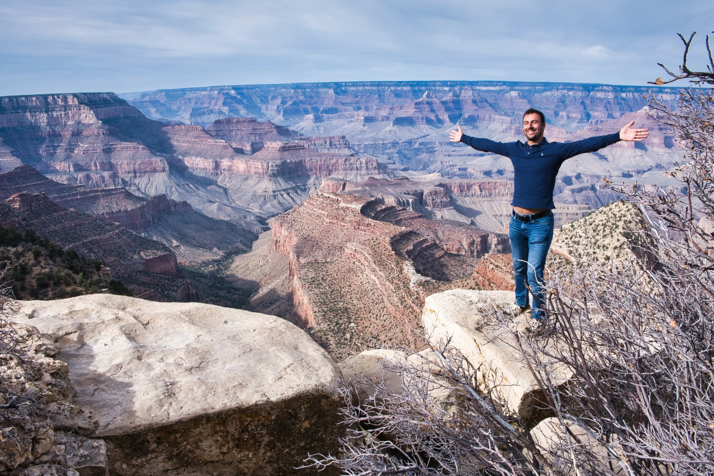
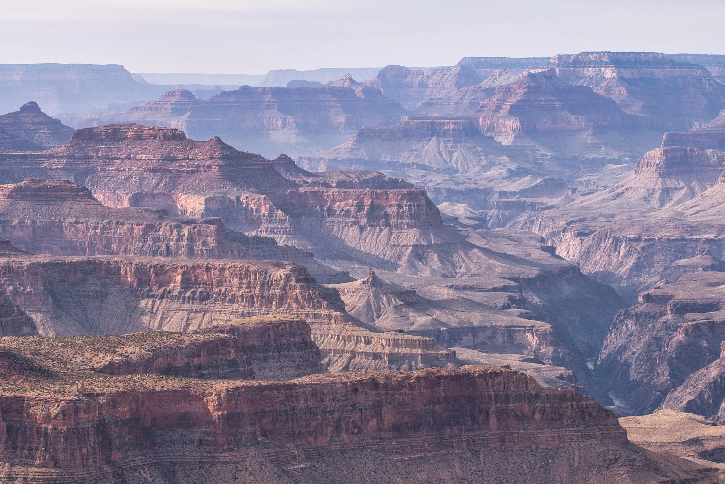
Having prepared ourselves, we soon realised just how unprepared we were for what our eyes would see. Yes, we’ve all seen the pictures and yes, we know it is a big hole in the ground but knowing this and seeing it are two different things. Our breath was taken away as we neared the edge and realised the scale of this hole. Our eyes started leaking and words failed us as we stood to try and take it all in. The unassuming road and vast flat plains had given way to a tear in the floor like nothing else we had witnessed.
This was a thin place…
Our thin place
Worshipped and revered by the tribes that had called this continent a home for thousands of years, this was the home of their ancestors and their animal spirits. Given that we knew how this place was created and surrounded by paths, car parks, toilets, people etc., and how we felt just standing there, we can only imagine how they must have felt just ‘happening’ upon it on some new adventurous travel. When the first Europeans, the Spanish, happened upon the Big Canyon in the 17th Century they were unable to find a way down to the canyon floor. It is thought that the tribal guides were unwilling to show the way and thus it remained unexplored by the Europeans until the mid 19th Century, when explorers rode the rapids and gained access from the river. Not until the end of the 19th Century, was the Big Canyon renamed the Grand Canyon!
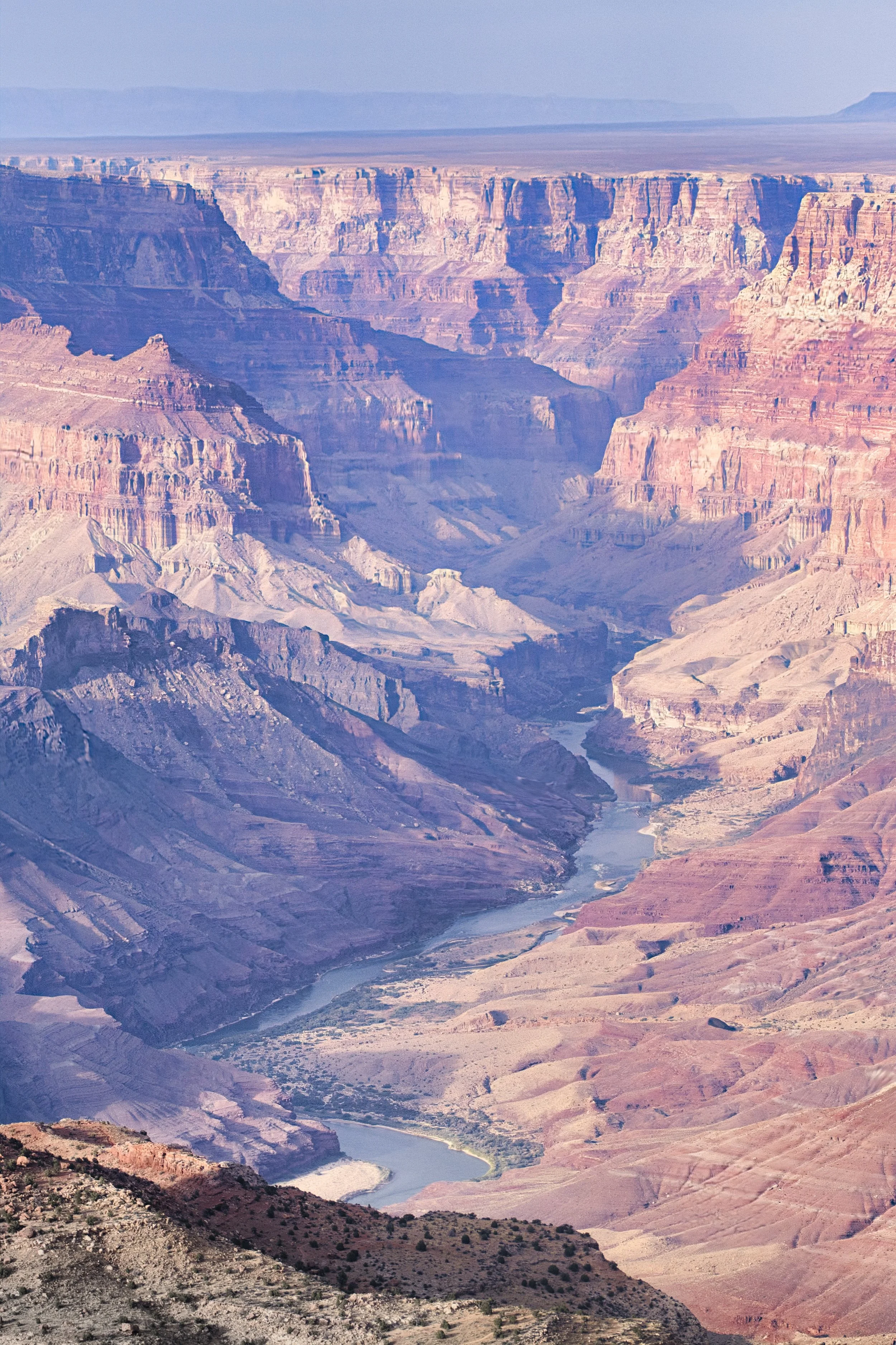
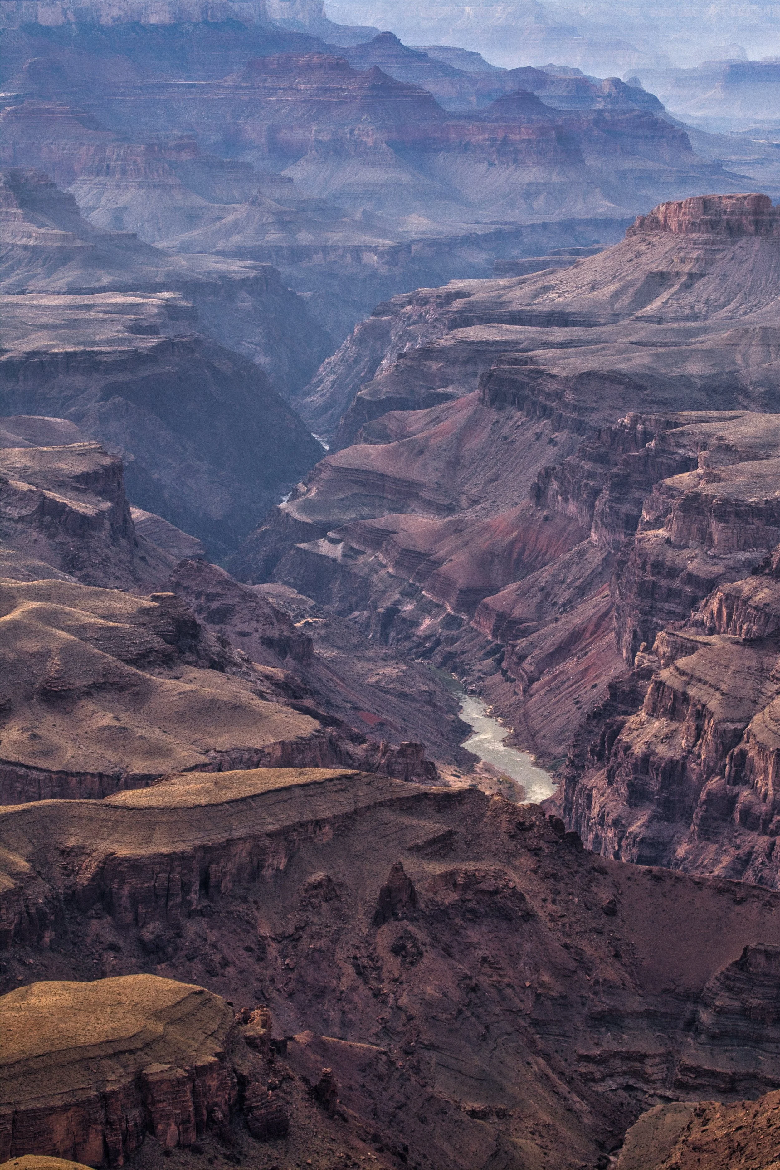
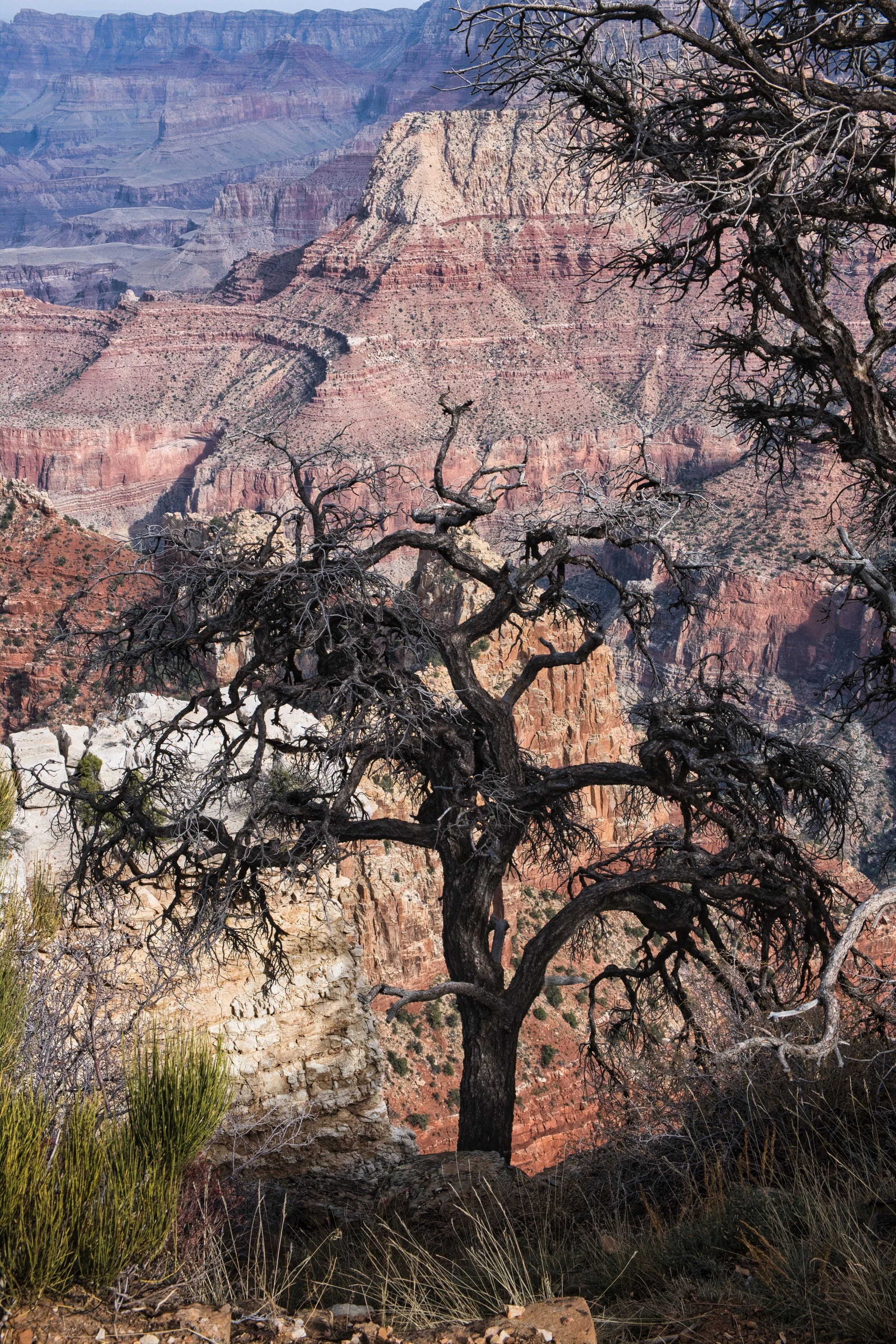
The geology of the canyon is still being understood to this day. Some areas of the canyon are 100’s of billions of years old, whereas others are a mere 5 or 6 billion. What all geologists agree is that the Colorado river is responsible for carving the canyon as the North American continent rose from the sea. Generally speaking, the river carved its way as the ground around it rose up. Whilst the rate of ground rising was reasonably consistent, the volume of river water changed depending on such things as ice-ages and latitude of the continent as it moved across the Earths mantle. In recent times, water levels are significantly reduced due to damming and extraction of water for irrigation and living in the desert, though in geological time, this is but a mere fraction of a second. The North Rim of the Canyon is approximately 300 metres higher than the south, showing the continuation of the uphill gradient we had ridden to reach the South Rim. Water and snow that falls to the north feeds the canyon, causing a greater number of tributaries than those to the south.
To give some stats on the size of the Grand Canyon, it is approximately 277 miles long, up to 18 miles wide and attains a depth of over 1 mile. If the canyon were filled with plaster of paris, removed from the mould and upturned, the height would be nearly twice that of Mount Snowdon, in North Wales (my reference when discussing heights with Isi). Whilst the Grand Canyon is not the largest or deepest in the world, it is considered one of the most impressive due to its very clear lines of sedimentary striation, that have formed since the Earth was young.
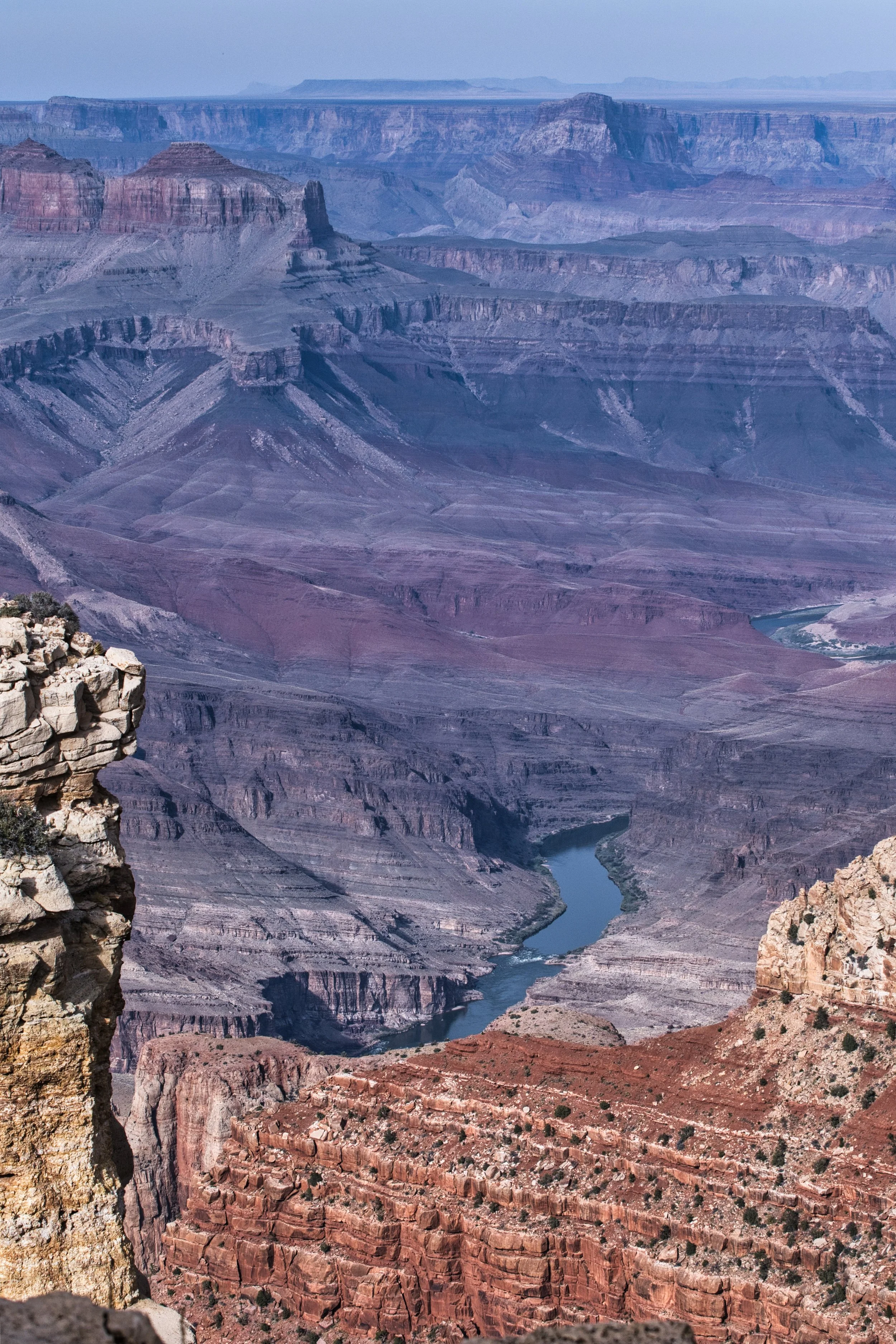
At this time of year, the North Rim was closed as temperatures dropped below freezing, the facilities were closed and they prepared for the forthcoming snows. We could just make out the hotel on the North Rim and the tributary to its side. This distance was estimated to be 23 miles.
Let’s just say it is big and impressive!
Safety first - wear a helmet…
The visitor centre
Having retained some of our abilities to function and move one foot in front of the other without fear of toppling over the edge, we returned to the bikes to find a min-bus parked next to us, with the occupants taking a keen interest in the bikes. Those pesky number plates were doing their ‘thing’ again…. It took us nearly 30 minutes to finally get moving.
We headed for the West Rim in the hope the road would be open to general traffic, whilst knowing it was only open to official tourist vehicles that could take (paying) customers to the Skywalk cantilever bridge of glass. We were, therefore, not disappointed when the West Rim was closed and we could only get as far as the village. The village is a terminal for the railway, one of very few that cater for people and specifically built to allow early travellers to access the hotel and visit the Grand Canyon. As we rode around the one way system and took in the historic buildings and layout, there was a herd of caribou that wandered around as if they owned the place. They probably do, as the cynic in me would suggest this herd was there for no other reason than to delight tourists and extract $$’s in the various support businesses that surrounded the historic train yard and served the herd.
As we returned toward the main road, I caught a glimpse of a deer patiently waiting to cross at the side of the road, so perfectly camouflaged that Isi did not initially see it, only to observe it cross the road in the rear view mirrors, as it was clear behind us. Another reminder of why riding bikes in natural areas can be so dangerous as the deer was so close yet so hidden.
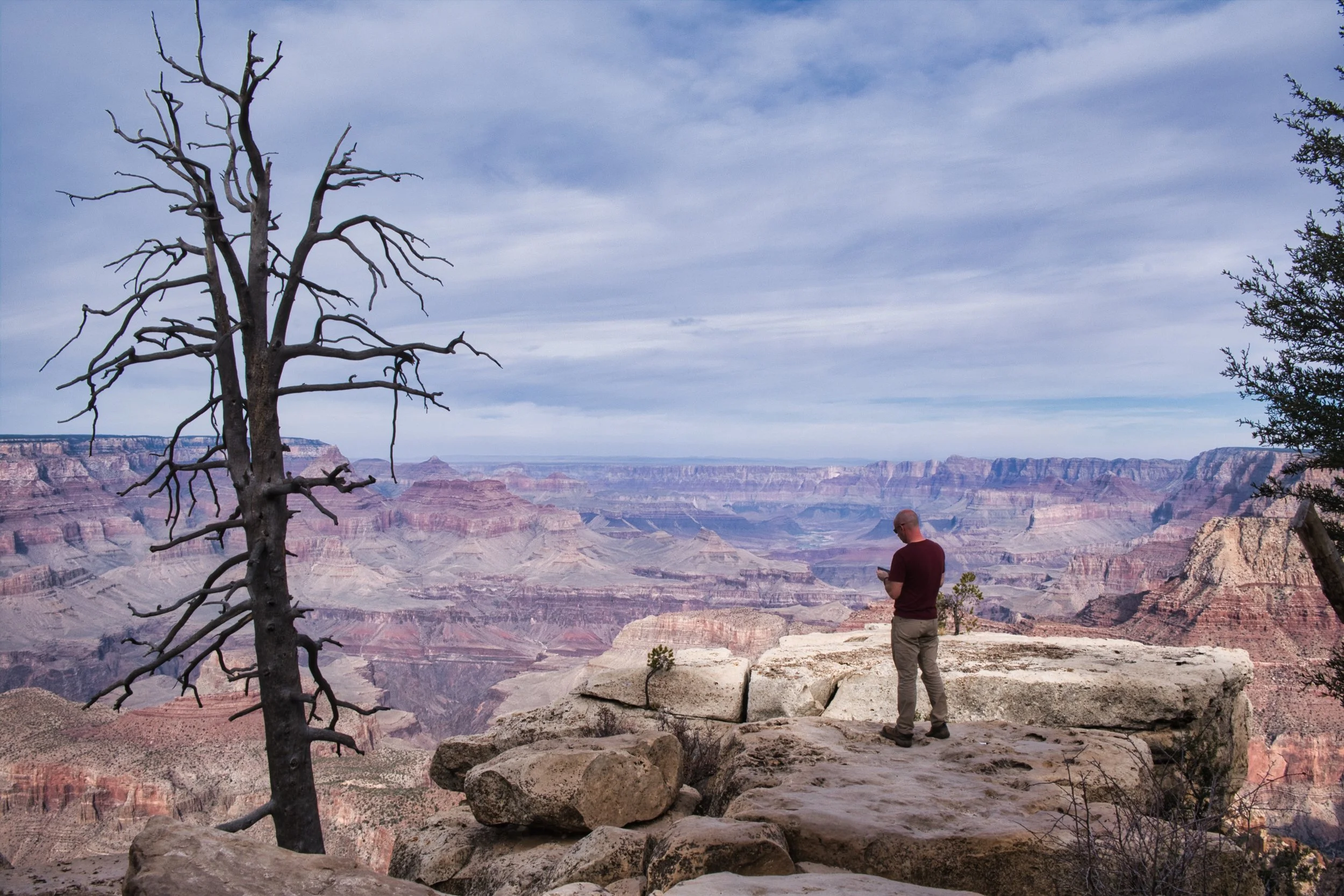
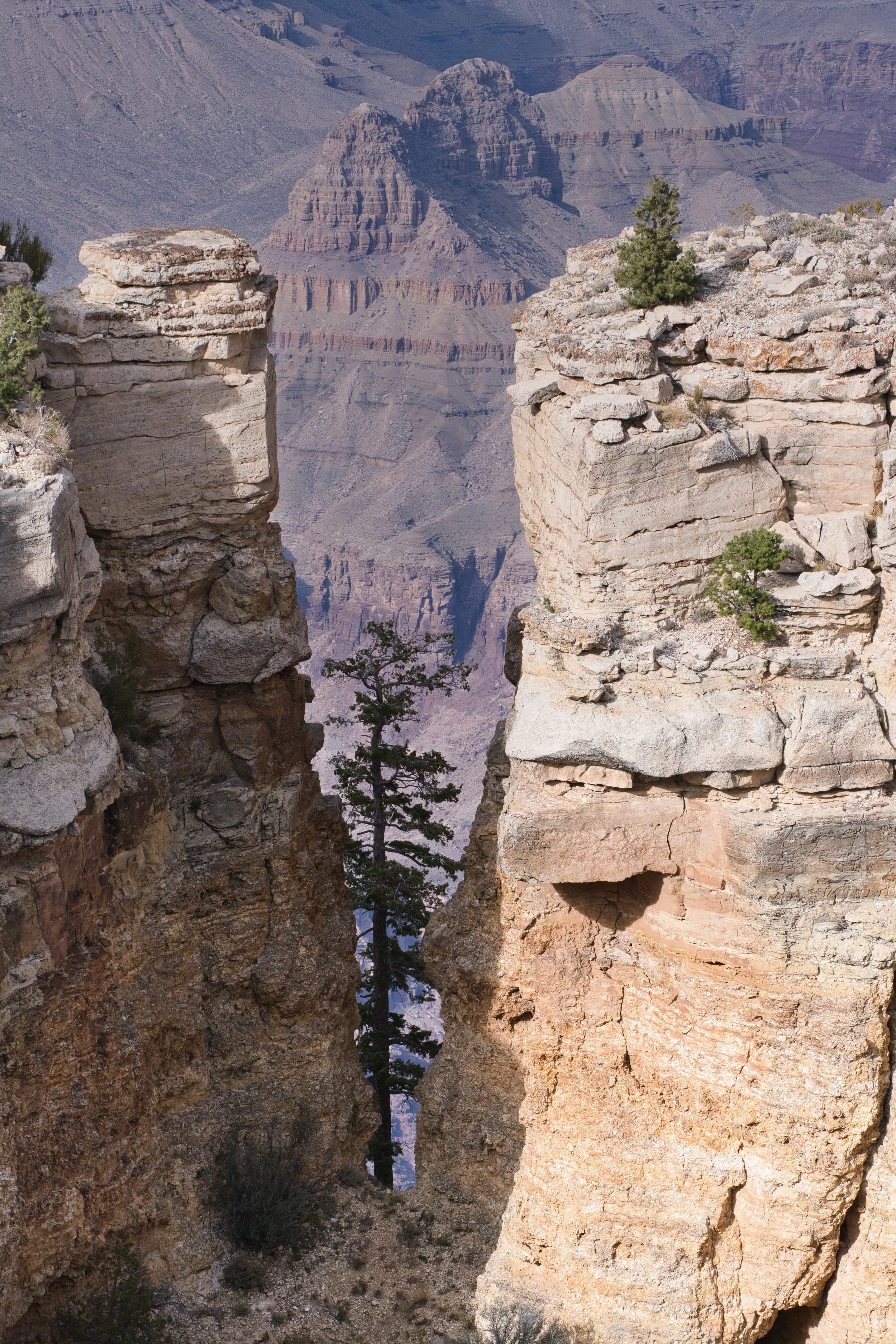
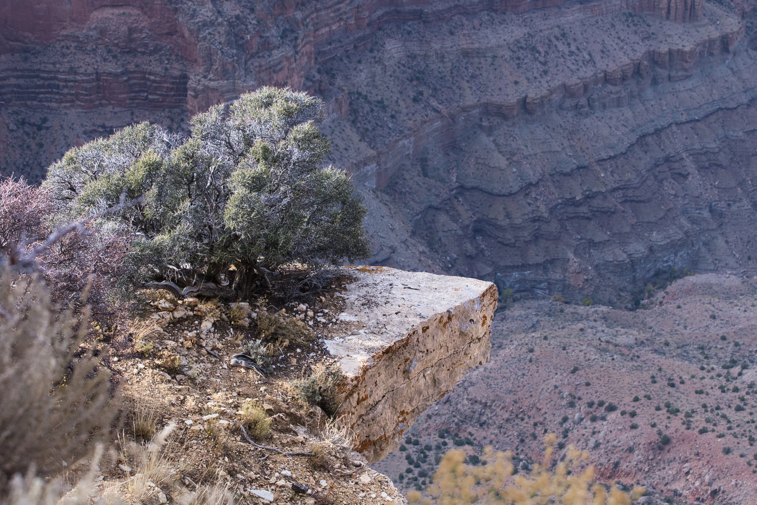
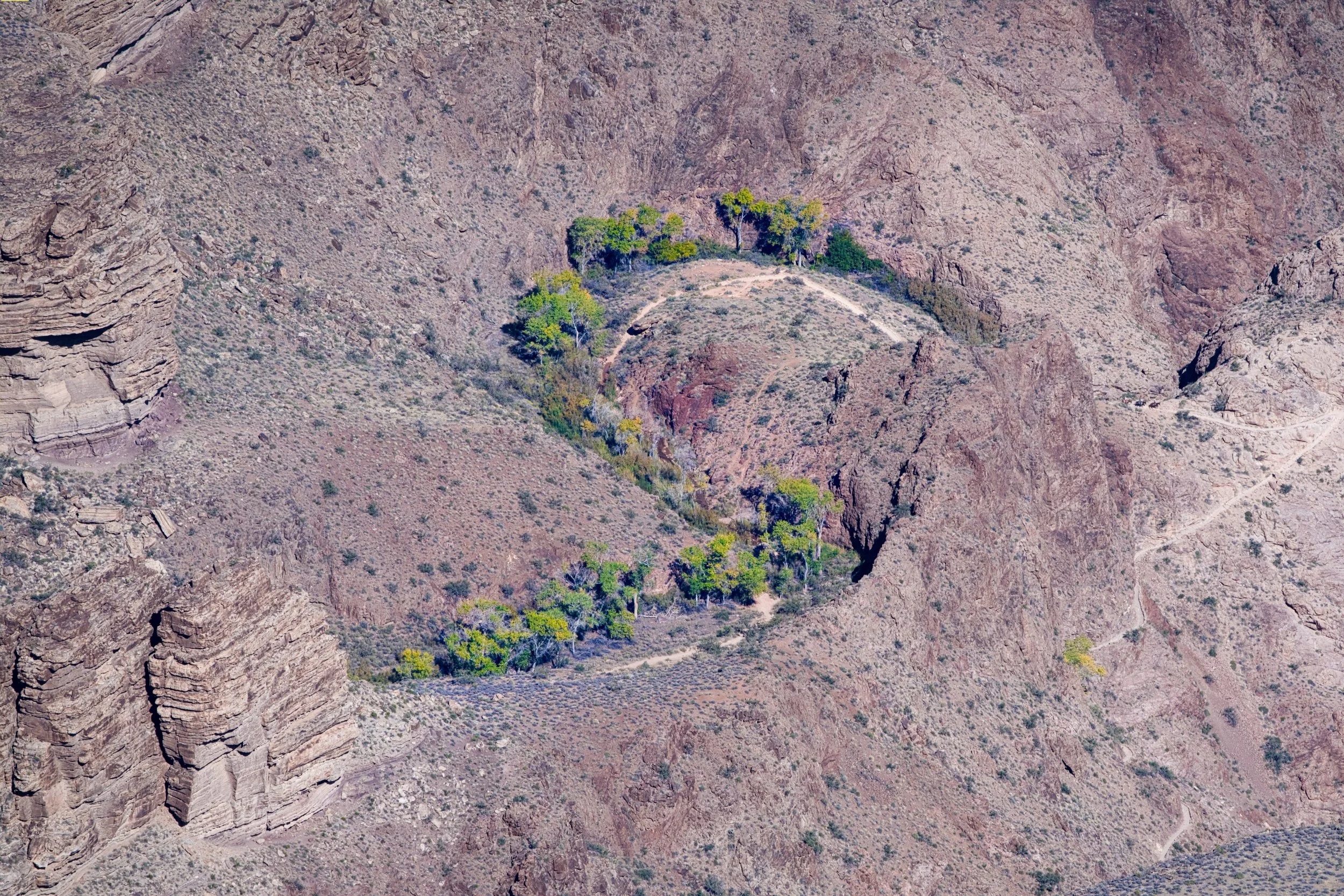
As we rode along the main road of the South Rim toward the Desert View Watchtower, there were numerous lay-bys and viewpoints at which we had to stop and try to absorb the magnificence and the magnitude of the changing views before our eyes. At one such place we sat on the wall with our feet dangling over the edge, eating our meagre lunch. A minibus pulled in behind us with just a few people on board. It became apparent they were on a guided tour and we listened in on the conversation, occasionally asking our own questions. The guide had produced a telescope, on a tripod, and had been showing his guests the people on the trail that led to the bridge at the bottom. As he invited us to take a look and truly understand the scale of the nearby cliffs and peaks, he told us of the trail that is approximately 27 miles in length, that takes you from one rim to the other. It is not recommended to complete in one day, as the increased temperature in the bottom easily leads to heat exhaustion.
Another lay-by, another view.
lunch…
The minibus left as we continued to finish our lunch and then back on our way. We joined up with the tour guide at the Grandview Point, where he suggested we nip around the edge of the carpark retaining wall, to get better views and shots than the way most would have taken. This was great but I was starting to get very tired of my testicles repeatedly jumping in my throat as my fear of heights and anxiety filled them and me with the dread of “what if” the cliff should crumble or the wind blow hard or any number of improbable but possible scenarios played out in my mind. Eventually, I had to give in and wandered back to the parked bikes while Isi took on her personal challenge.
The Grandview Point was also the start of one of the few old, tribal trails that leads to the bottom. There were no newly placed flagstones or handrails to assist you in the descent and the throng of people jostling for position meant you either clung to the rock face like a limpet in a rock pool, or took your life in your hands to pass. After a few turns, there was a small peninsular with steep drops either side and a ‘jump/step’ across a gap to stand on the edge. Isi had reached her limit but took photos of those that felt more comfortable. Isi was happy to take their photo, though disappointed the resulting images did not reflect the gravity of the place.
Isi’s peninsular
Mind the Gap
Whilst Isi was off playing with her nerves, I was resting by the bikes, bringing my heart rate back to a normal level. The number plates were, yet again, doing their thing and I got in to conversation with a young couple about our trip and how, god-willing, they hope to do something similar themselves one day. As they walked away, I couldn’t help but notice the hand-gun holster strapped to his thigh and I had to wonder how such strong religious believers needed the protection of a weapon instead of trusting in their god who looked over them and had, just moments ago, blessed us on our travels. Obviously, I will never truly understand the world where carrying a gun is seen as common practice and just as familiar as putting your shoes on before leaving the house.
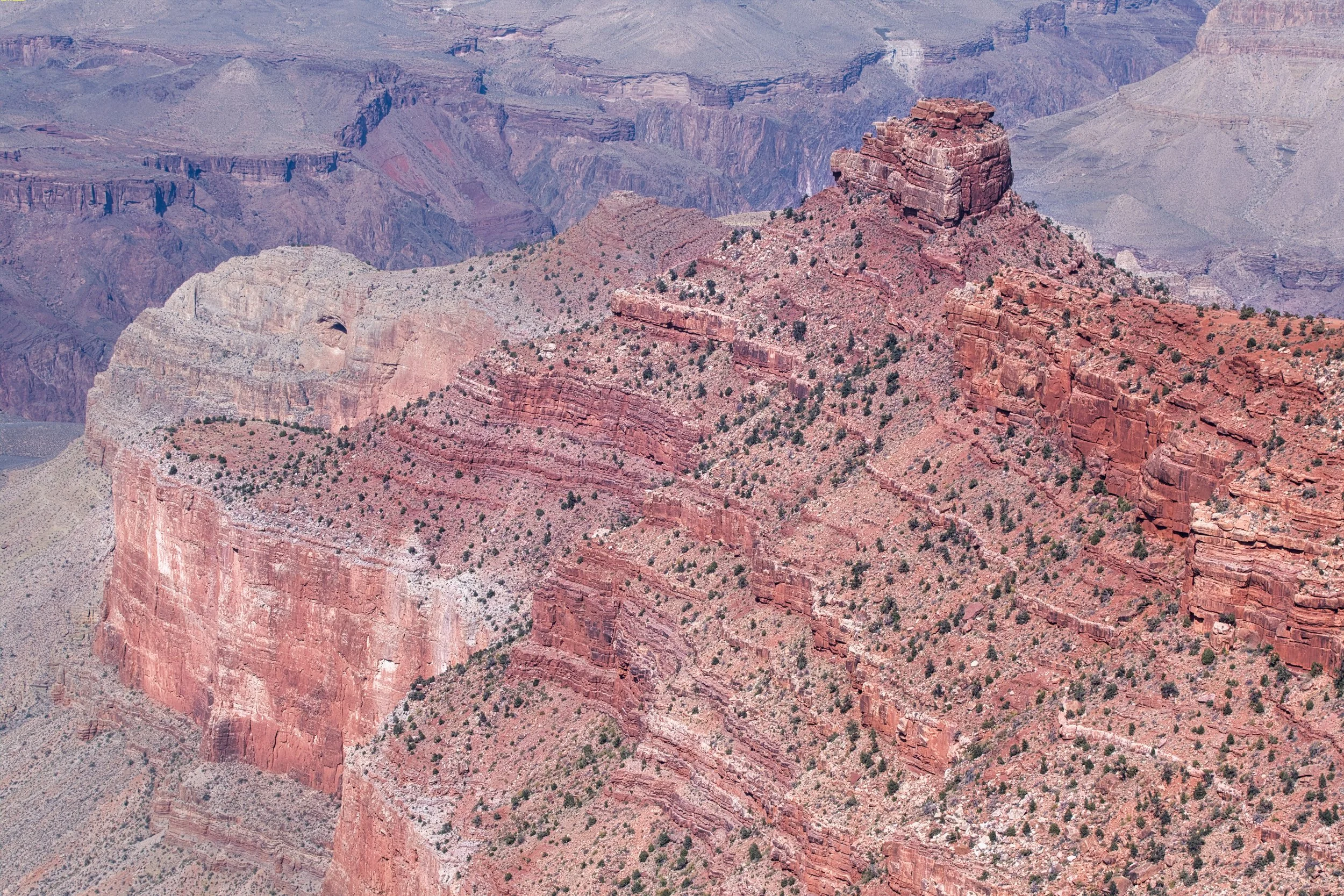
As the day wore on and we hopped from one lay-by to the next car park and then a lay-by, we reached the turning point of our day, Navajo Point and the Desert View Watchtower. The watchtower was designed and built, in the 1930’s, to resemble an Ancestral Puebloan watchtower, though none are known to have ever been as big or as grand as this. The base of the tower is purposefully distressed and built to look like former ruins. The watchtower is a visitor centre with upper floors providing views of the Eastern edges of the canyon. There was nowhere near we could park the bikes, even though we tried a dirt track just to get closer.
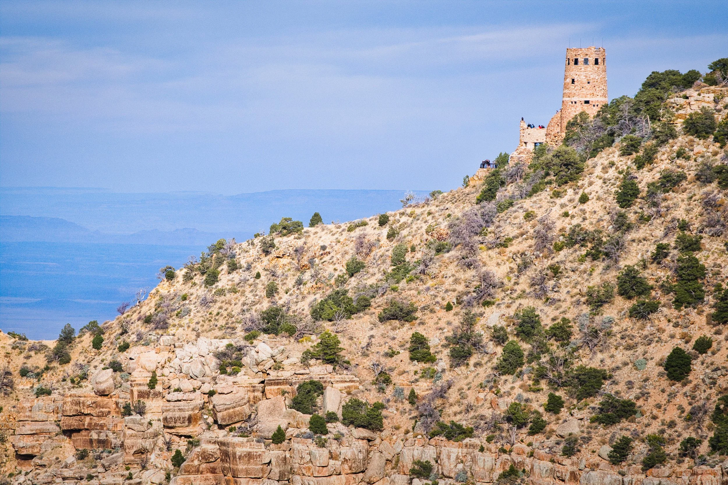
Puebloan watchtower
Developments of both the North and South rims continue to be proposed, with one such development proposed in 2014. On 420 acres, there would be shops, an IMAX cinema, RV park, hotels and a gondola to reach the canyon floor where a "riverwalk" of "connected walkways, an eatery, a tramway station, a seating area and a wastewater package plant" would be situated. The Navajo Nation Council voted against the plans and, in my opinion, it was the right decision. Theme parks have their place and their audience, with Las Vegas just a few hours up the road, the area can cater for both.
And so we turned back, heading West along the rim road, enjoying the wooded areas that would open up and provide glimpses of the canyon beyond, then we turned South and the gradual drop back to our room, gasping for a cup of tea that was never going to happen. On our return, the hotel had been busy putting up Christmas decorations (it was bonfire night!) that, in my opinion, did nothing to hide the cheap and poor quality of the establishment. However, even the thought of Christmas did nothing to dampen the emotions of what had turned out to be a major highlight of our trip so far. Yes, a tourist honey-spot, but also one of the marvels of the natural world, predominately natural and untamed. Memories and emotions that will remain with us forever…
1 mile down…
That same mile…
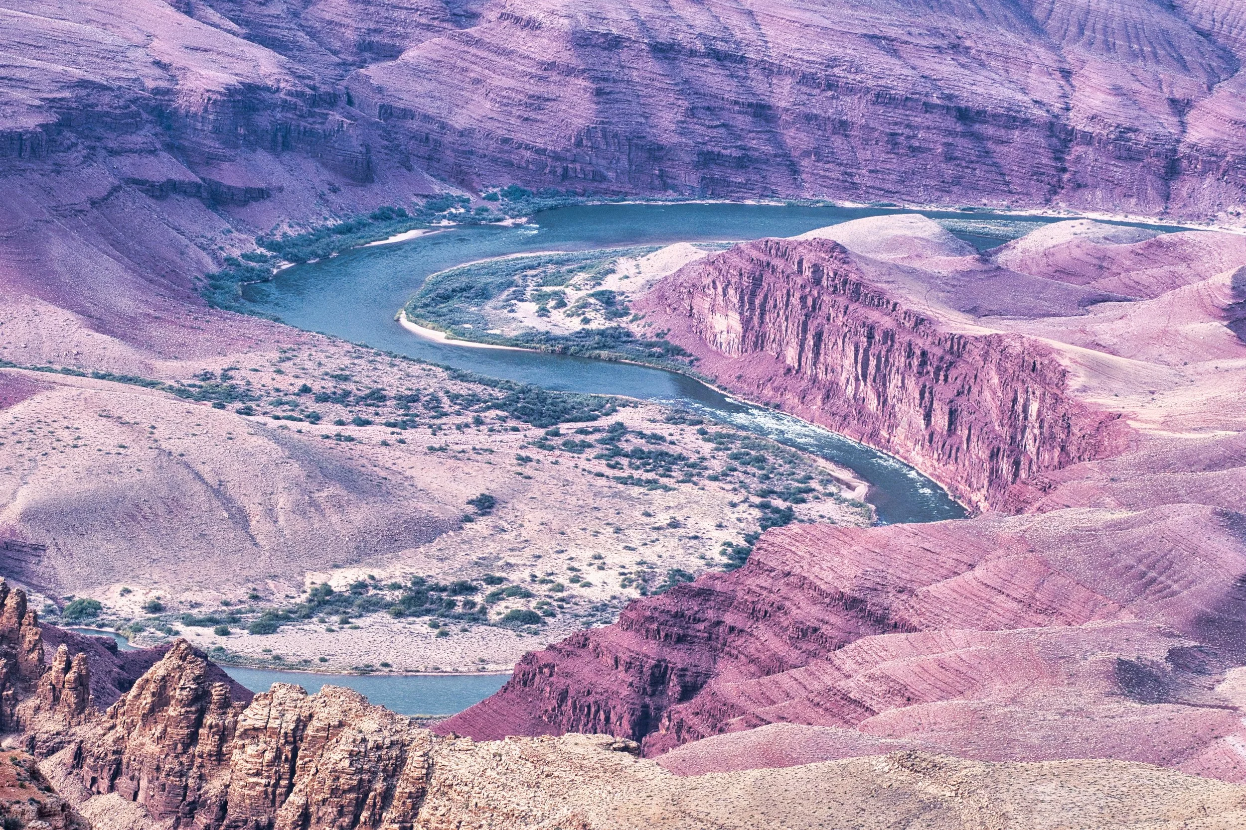
River bends
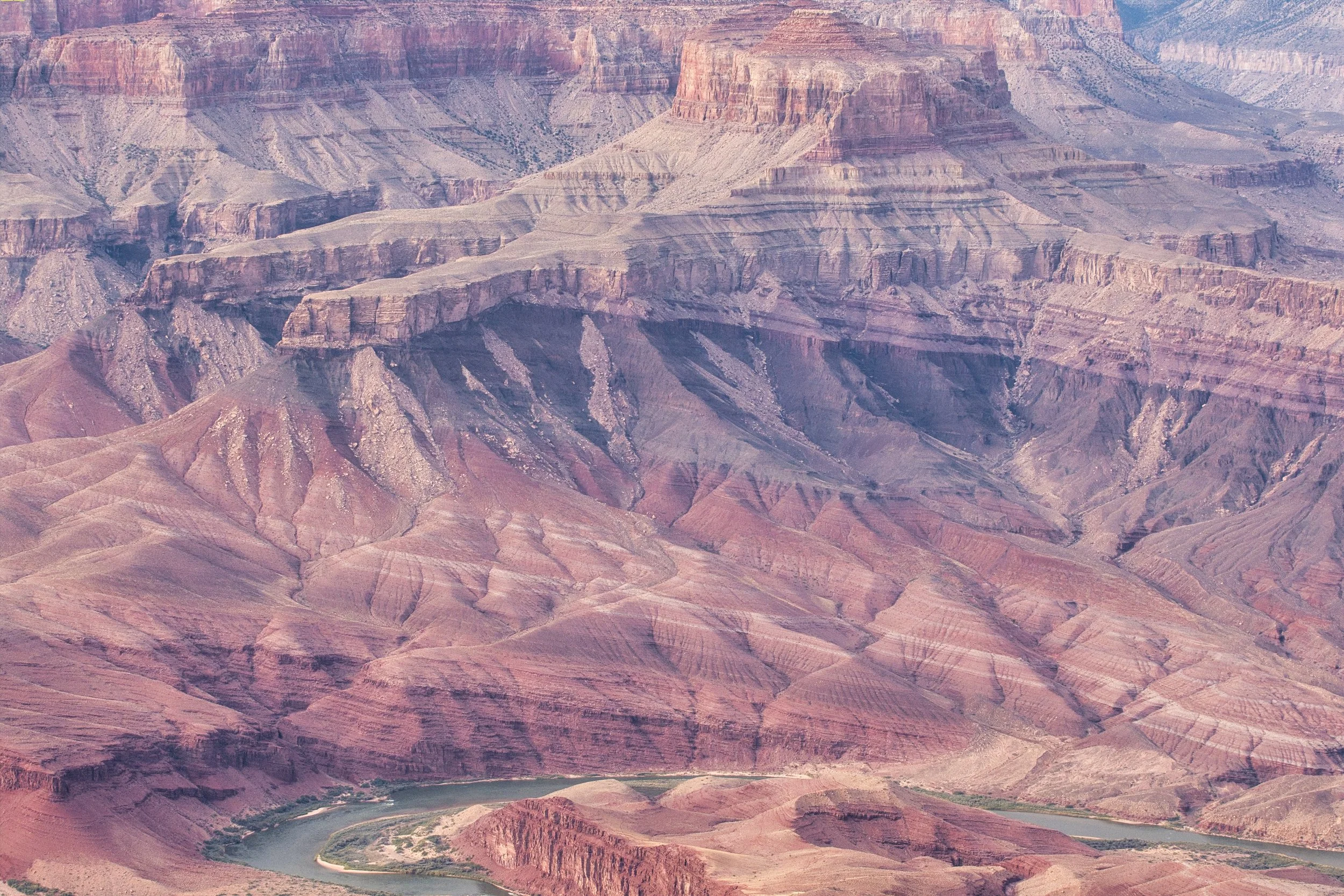
Geological history

Layers
There are people on the trail
Between a rock and a hard place
Rapids
NOT my lunch seat…
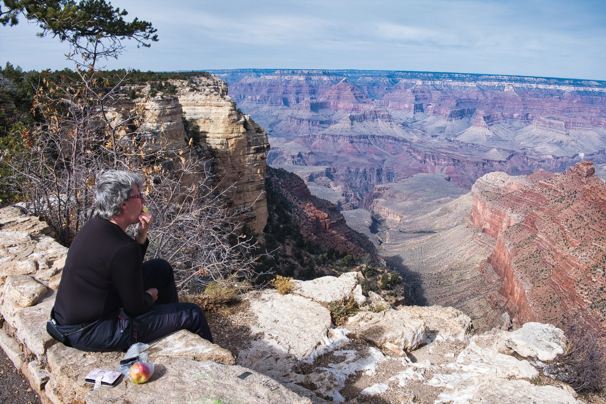
Lunch seat
The power of water.